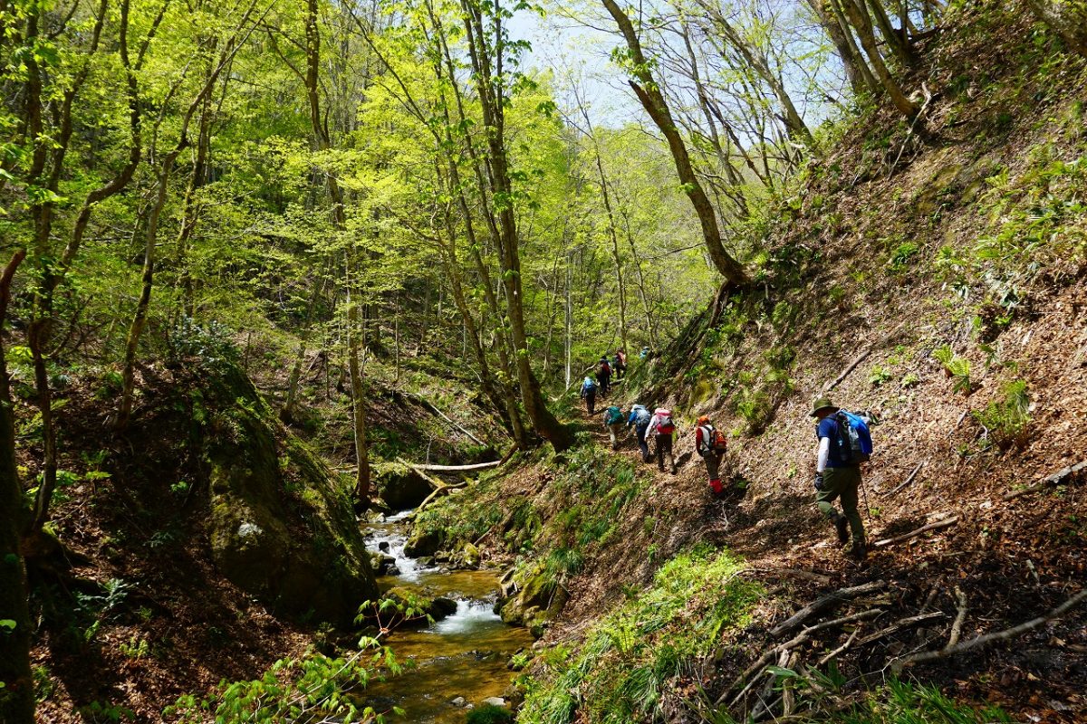
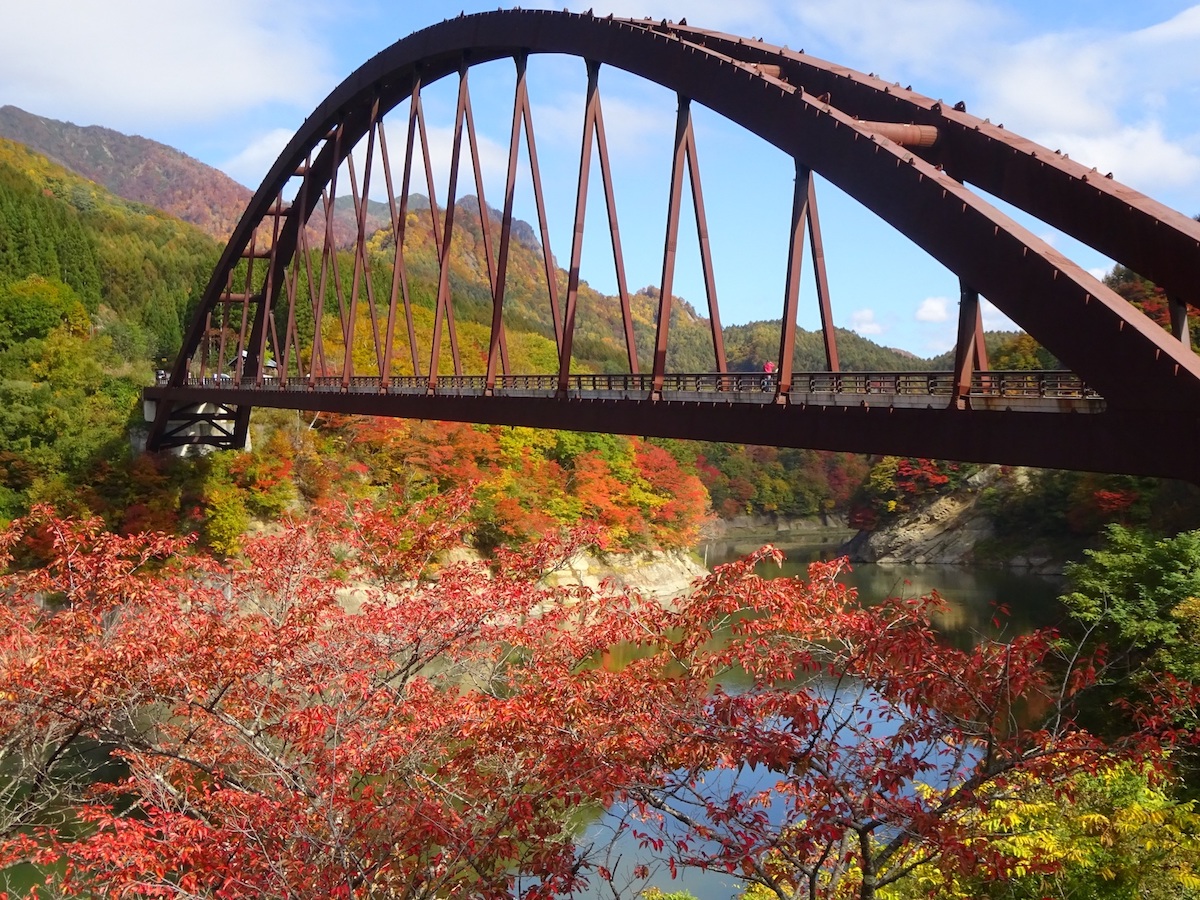
Okususobana Valley
Experience layers of the earth that tells of its ancient history!
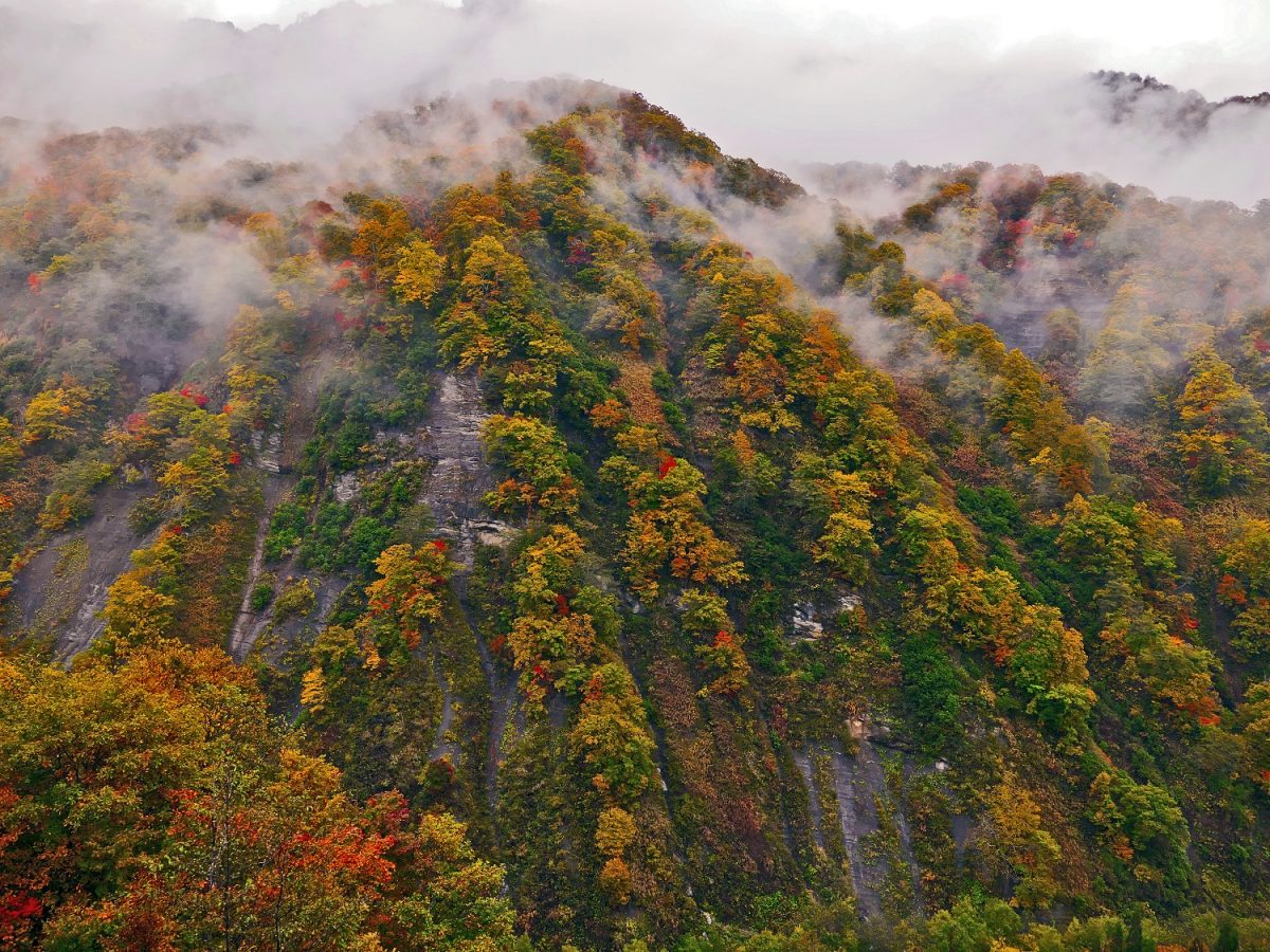
Starting from the Okususobana Dam and Okususobana Bridge, the roughly 10 kilometer long valley that twists and turns is an open-air museum displaying the bottom of the ocean that once tied Kinasa to the Japan Sea. The waterfalls pouring over the cliff walls and the autumnal leaves woven into the landscape are very popular. The area gives you a real feel of how the Shinshu landscape was formed.
Autumnal leaves peak viewing period: Mid-October – late October
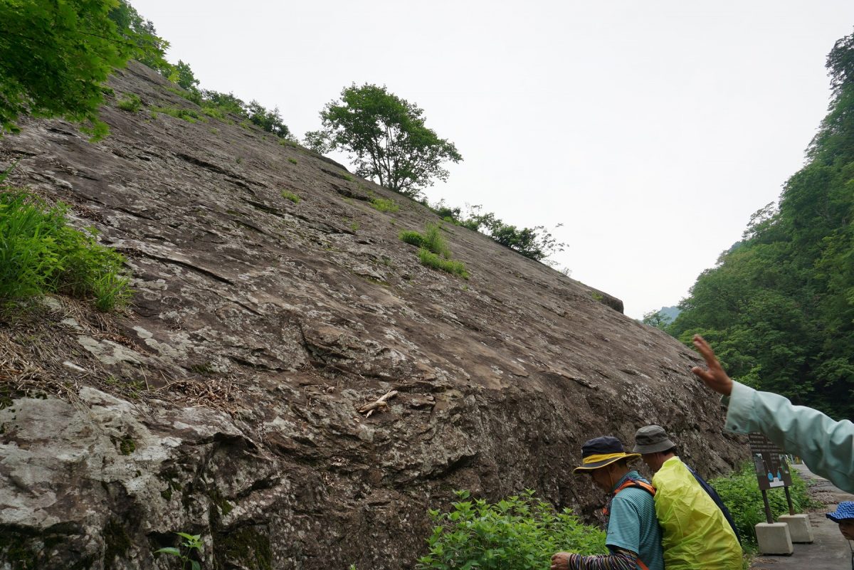
In the valley, you can actually touch layers of earth that are three million years old. You can also observe the Senjojiki Boulder that indicates the area was once at the bottom of the ocean, along with fossilized burrows, sand pipes, erosions in the terrain resulting from the land rising (cuestra formations and pot holes), and other faults. Fossils from the now extinct Stegadon have also been discovered here.
*Note
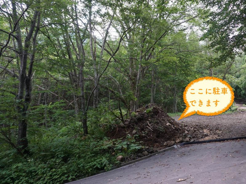
- There are no parking spaces on the road that runs along the valley. Please watch out for cars coming and going, and park your car carefully when you want to take photos.
- The road that runs along the valley is one way from the Okususobana Bridge and runs in a loop.
- The valley is closed in winter. Also, there are times the road is closed due to disaster reconstruction, so please check the Kinasa Tourism Association homepage.
<The park will be temporarily closed from July 1 to September 30 in the 2024 season for disaster reconstruction.>
Okususobana Nature Park
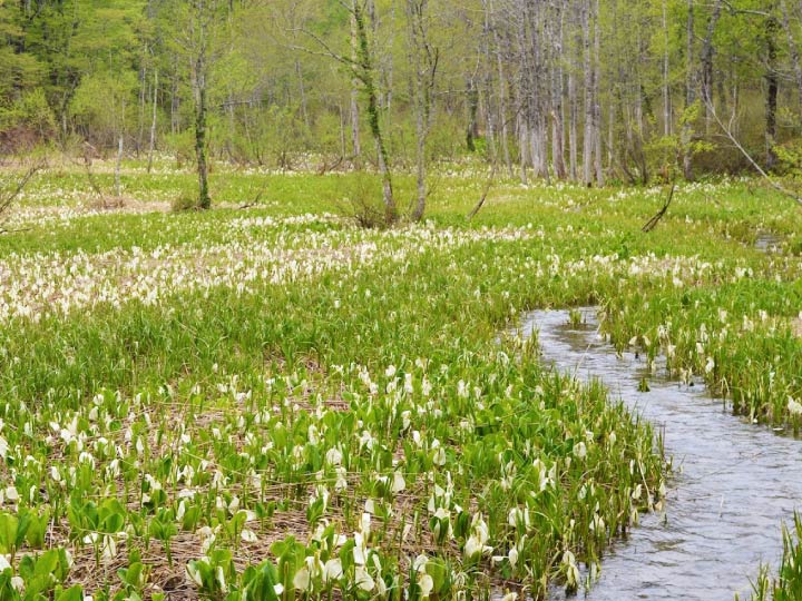
Okususobana Nature Park is located near the source of the Susobana River near the Niigata border. The park is home to one of the largest colonies of mizubasho (skunk cabbage) in Japan, and as the snow melts, they start to show their refined white figures from around Golden Week (late April) until early June.
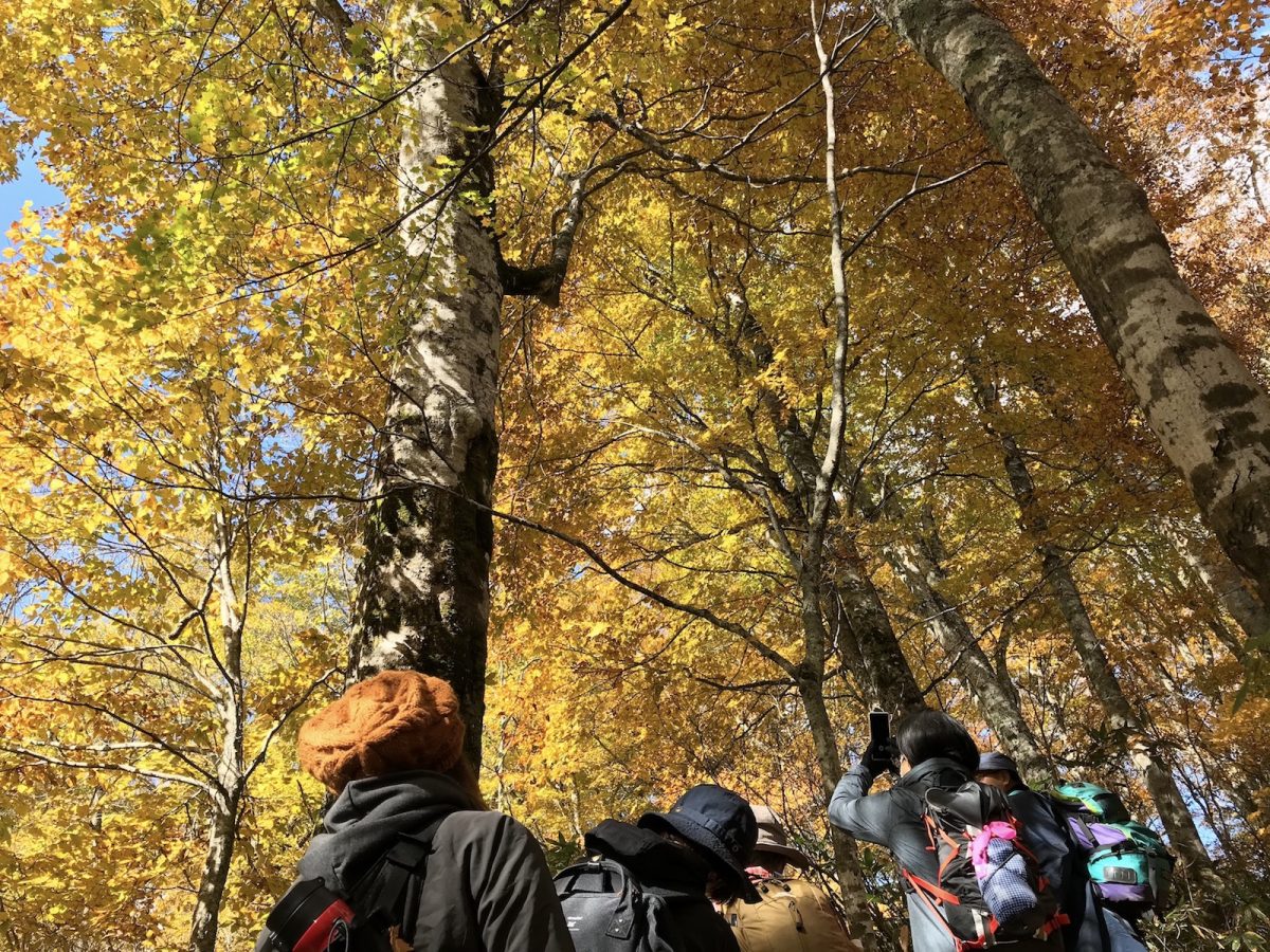
The ancient beech forest that stretches throughout the park is the perfect spot for forest bathing. From the buds that bloom in spring through the leaves changing color in autumn, the park is constantly changing its appearance. The leaves start changing color around mid-October and can be enjoyed throughout the park and the Okususobana Valley, which acts as the approach to the park, through the end of October.
The park is home to 60 varieties of wild birds, the Japanese black salamander, the forest green tree frog, which is a natural monument as designated by Nagano Prefecture, bears, deer, monkeys, and many more wild animals.
Mizubasho (skunk cabbage)
- Viewing season: From late April through early June (the flowers bloom in order of the places where snow has melted)
- Peak season: Normally from May 10 to May 20 (varies depending on the weather conditions)
Autumn leaf season
- Viewing season: From mid October through late October (varies depending on the weather conditions)
*Note
- Entering Okususobana Nature Park requires an entrance fee. (410yen/person Apr 29-May 31, 200yen/person June 1-October 31, Children under elementary school are free. 6/1〜10/31)
- The park is closed in winter. Also, there are times the road to the park is closed due to disaster reconstruction, so please check the Kinasa Tourism Association homepage for information on park operating hours.
<In the 2024 season, it is temporarily closed from July 1 to September 30 due to disaster reconstruction.>
Mt. Nakanishi
Elevation 1,741 meters
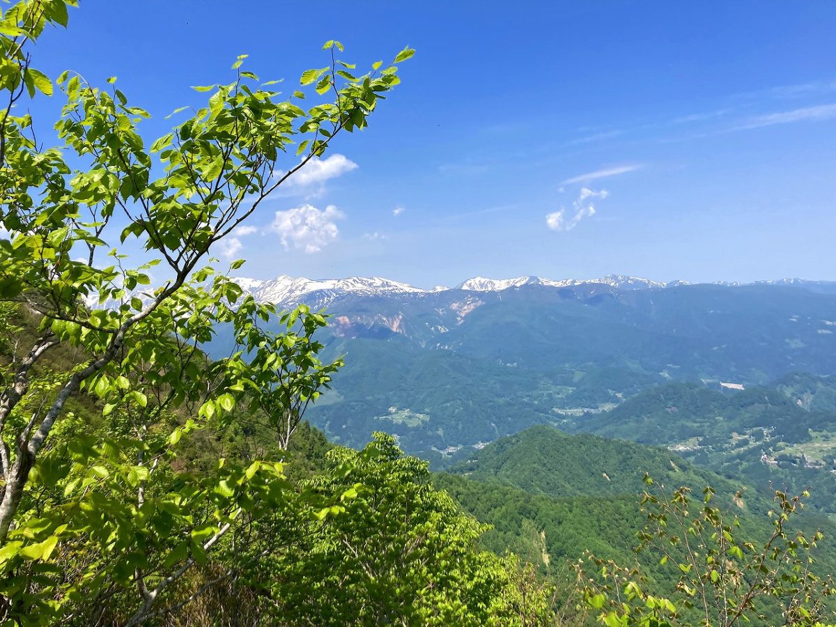
There is a trailhead in Okususobana Nature Park allowing you to hike the mountain during the season the park is open. Snow gear is necessary from late April until just after Golden Week (the first week in May) as some snow still remains. As the snow melts, you will gradually encounter many beautiful wild flowers.
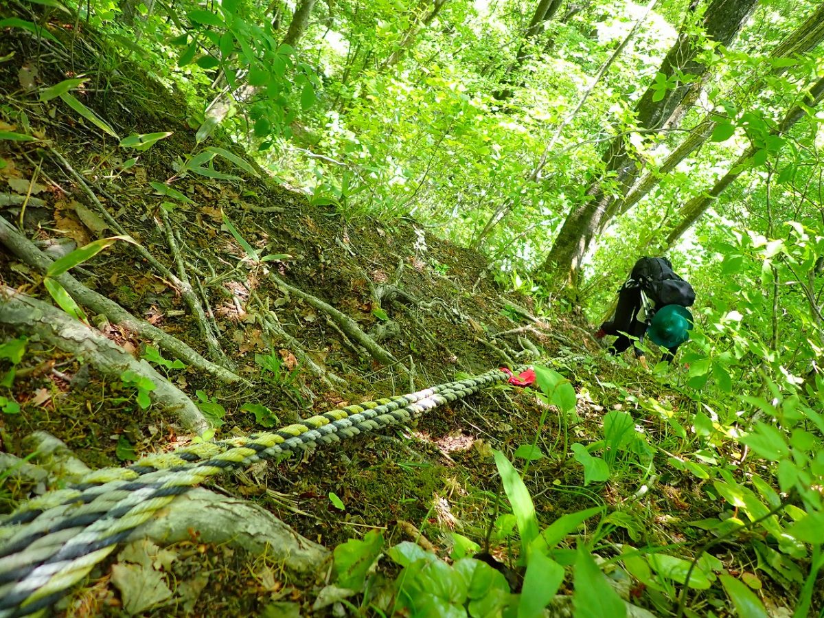
In autumn, the colors of the leaves change on the beech, maple varieties, katsura, Erman’s birch, and many other tree varieties found on the mountain. If the weather conditions are right, the summit offers a wonderful view of many of the surrounding mountains from the Northern Alps to Mt. Nishidake and Mt. Takazuma of the Togakushi mountain range. The road is very steep in many places until you reach the ridge, so trekking shoes are a must. (It takes approximately three hours from the park’s parking lot to the summit.)
Daibo Mountain Pass
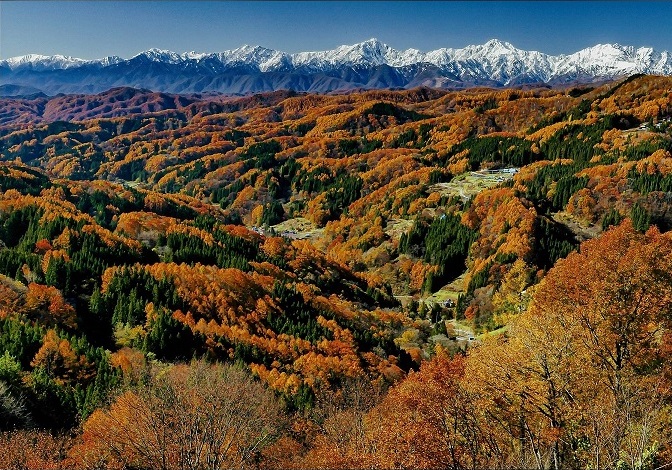
Mt. Ichiya-san, said to have been built overnight by demons, and Mt. Nishidake tower before you, and when the weather is good, this observation point offers a full-scale panoramic view of the Northern Alps far off in the distance.
Access: 15-20 minutes from the roadside rest area, Tabi-no-eki Kinasa. Take Route 36 in the direction of Togakushi, and after you pass the sharp curve just beyond Juni Shrine, take a right at the “Daibo Mountain Pass” sign. The parking lot can accommodate five cars. A public restroom can be found along the nearby prefectural road.
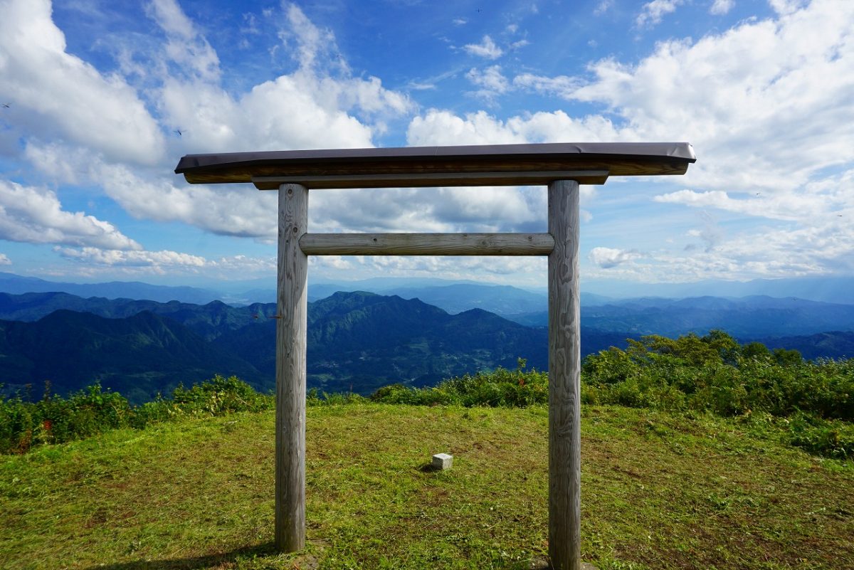
Mt. Ichiya-san
Elevation 1,562 meters
This cone-shaped mountain stands in practically the center of Kinasa. From the summit you can see a grand panoramic view of the Togakushi mountain range and Northern Alps. It takes between 1.5 – 2.5 hours from the parking lot to the summit. There are no dangerous rocky areas making it perfect for beginners.
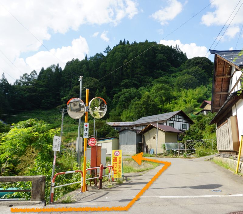
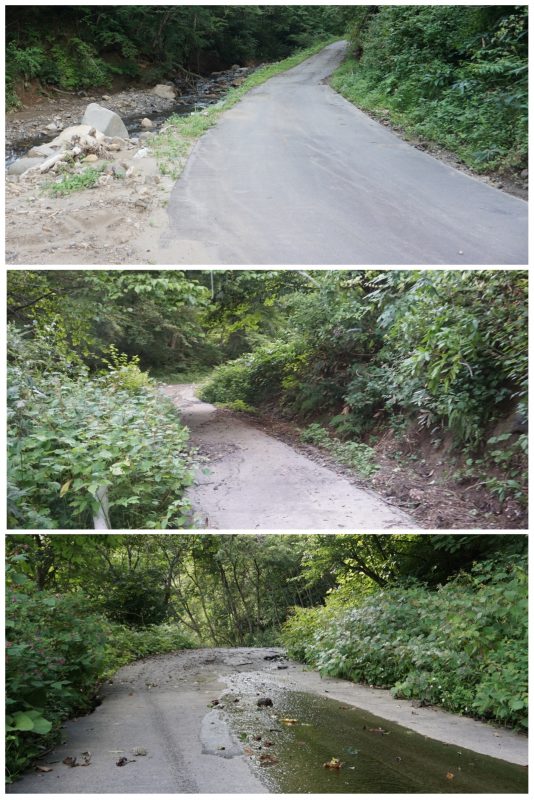
*The municipal road that leads to the trailhead parking lot is so narrow that two cars coming from opposite directions cannot pass each other. Please take extra care when driving.
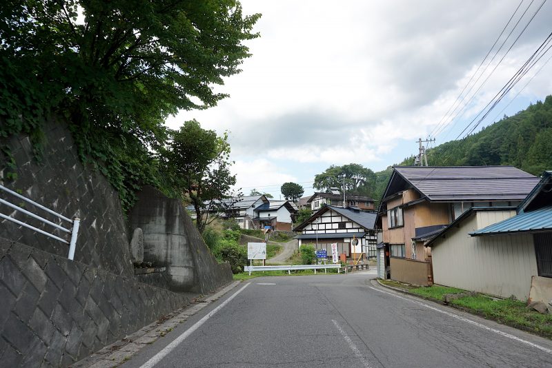
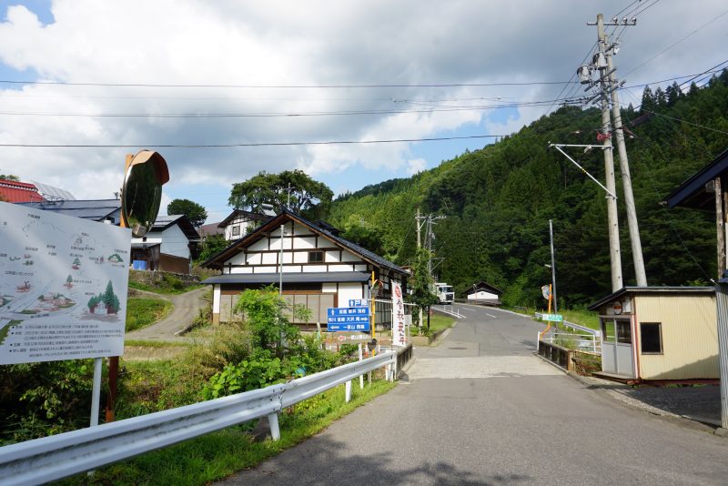
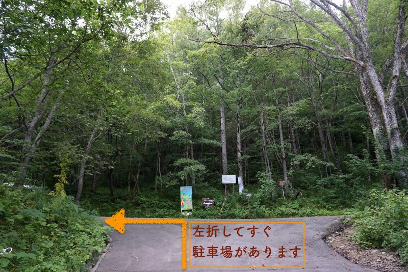
How to get to the Mt. Ichiya-san trailhead parking lot
Please refer to the map illustrations and photo guidance to access the parking lot.
https://goo.gl/maps/DwTAbqEqtopJ9LsP8 (Lat=36°42’12.0″N / Lon=138°00’47.8″E)
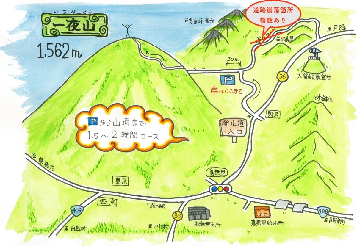
- Take route 406 from Nagano to Kinasa, and turn right at the Kinasa intersection onto route 36. (Continue straight along the road with Kinasa Shrine on your left and Ichiboshi liquor store on your right.)
- Continue to follow route 36. Do not cross the bridge that you will see on your right. Instead go in the direction of Togakushi and Shinazawa Highland.
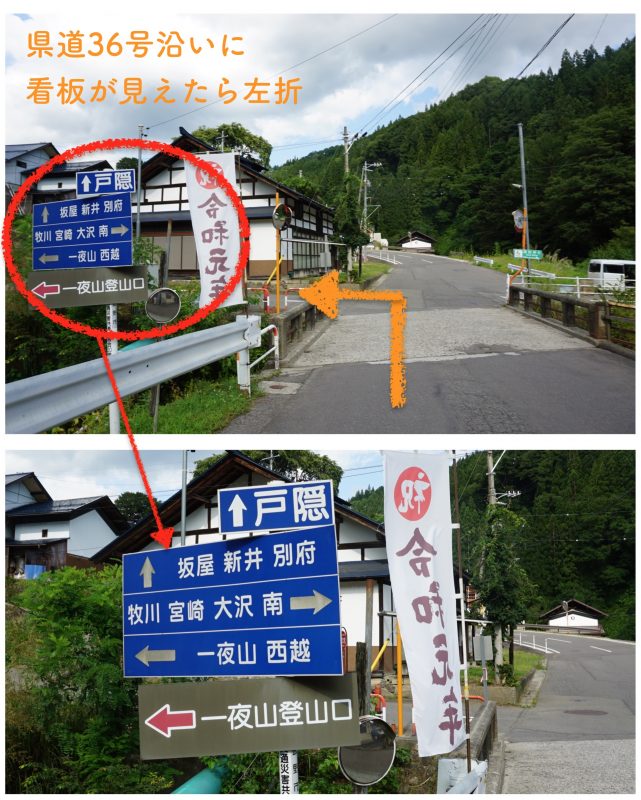
- There will be a sign indicating the Mt. Ichiya-san trailhead a 5-minute drive away from the Kinasa intersection. Turn left at the sign.
Mt. Sunahachi
Elevation 1,432 meters
This is the highest peak of Mt. Arakura, one of Shinshu’s Hundred Famous Mountains, located on the Togakushi border. From various places along the ridgeline you can see amazing views of the Togakushi mountain range, Mt. Nishidake, Mt. Ichiya-san, and the Northern Alps. This mountain is for intermediate to advanced climbers with narrow trails, skinny ridges, and chain rails to give you thrills on a course with a wealth of variation. Please bring equipment for walking on steep rocky paths and mountain trails.
Karayama Mountain Pass
This is an ancient road that once connected Hakuba to the Japan Sea via what was known as the Salt Road or the Chikuni Kaido Highway. Until the 1950’s it was used as a road in everyday life, therefore it can be fun to look for the Bato Kannon (horse-headed Kannon), Dosojin (deity of travelers) and other roadside deities. It is great for beginners, but some portions have steep inclines and there are small creeks without bridges that have to be crossed.